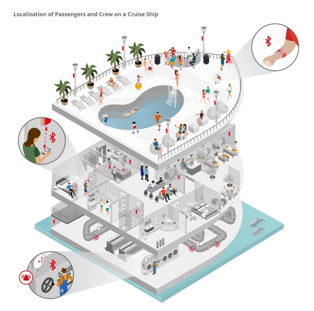
A tracking system on a cruise ship enables the opportunity to guarantee a better experience for the guests on board and enhances the safety for children and crew.
AT A GLANCE
client-based solution (smartphone app):
- 2D/3D maps
- indoor navigation on board
- „Buddy Finder“ function to share position
server-based solution:
- “Kid Finder” function
- localization of crew in emergencies
PROBLEM DEFINITION
Cruise liners are huge ships with a guest capacity of several thousand people, numerous cabins, restaurants, pools, and leisure facilities spread over several decks. Orientation in a place like this is not easy for most passengers. Finding one’s cabin is not only a problem when passengers embark, but also later on the cruise when trying to return to the room after an eventful day. Navigating to one of the multiple POIs on board can also take much longer than expected, the deck plans are usually not sufficient for stressless wayfinding. It is also hard to know what events are on and where they take place.
On such a big ship, parents often struggle not to lose sight of their children. Not being able to relocate them quickly subjects the children to high stress.
In the case of an emergency, operators need to make sure that nobody of the crew is still in an area of risk.
SOLUTION
Indoor navigation enables finding the quickest, easiest route possible to any chosen destination on the ship. App functions can include navigating around the ship, finding friends (ability to share location), viewing the event calendar and the restaurant’s menus. If parents lose sight of their children, they can view their location on a digital map and retrieve them quickly.
An analysis tool provides real-time data about the visitor flows and lengths of stay, allowing operators to gain insights into the passenger’s behavior, which in return makes it possible to optimize onboard operation.
Workers carry beacon cards that work as a safety measure for the ship’s crew. In the case of an emergency (e.g. a fire or gas leakage in the machine room), presence monitoring provides information on whether someone of the crew is still in hazardous areas and allows for a quick and safe evacuation. The beacon cards can also be used to unlock doors to restricted areas, enabling simplified access control.
TECHNICAL IMPLEMENTATION
infsoft Locator Nodes are installed in all relevant areas of the cruise ship. The passengers’ smartphones receive Bluetooth signals from the Locator Nodes and use signal strength measurement for localization. This enables a precise turn-by-turn navigation that leads the passenger from the current location to any POI on a digital map. It is necessary to install a corresponding app for this. The devices can also transfer the data to the infsoft LocAware platform®, where it is intelligently processed and can be used for analysis purposes, displaying the data via heatmaps and customizable diagrams.
Children wear Bluetooth Low Energy (BLE) beacons in the form of unobtrusive wristbands, the crew in the form of ID cards. The Locator Nodes detect the beacons’ signals and transmit the data to the infsoft LocAware platform®, where it is managed in real time and the position is displayed on a map. Parents can see the location of their children in an app, operators can monitor the crew’s presence in a smartphone or browser application. A back channel to contact endangered persons can be implemented optionally.


