More and more businesses aim to digitize processes and profitably use solutions for locating objects, vehicles, or even people. In this blog post, we will illustrate the successful setup of a server-based tracking system. In our exemplary project, assets are to be localized in an office environment.
An RTLS (Real-Time Locating System) based on Bluetooth Low Energy beacons, which are attached as tag hardware to the goods to be tracked, is a suitable choice for this application. infsoft Locator Beacons and infsoft Locator Nodes are used as infrastructure hardware.
1 | Digitization
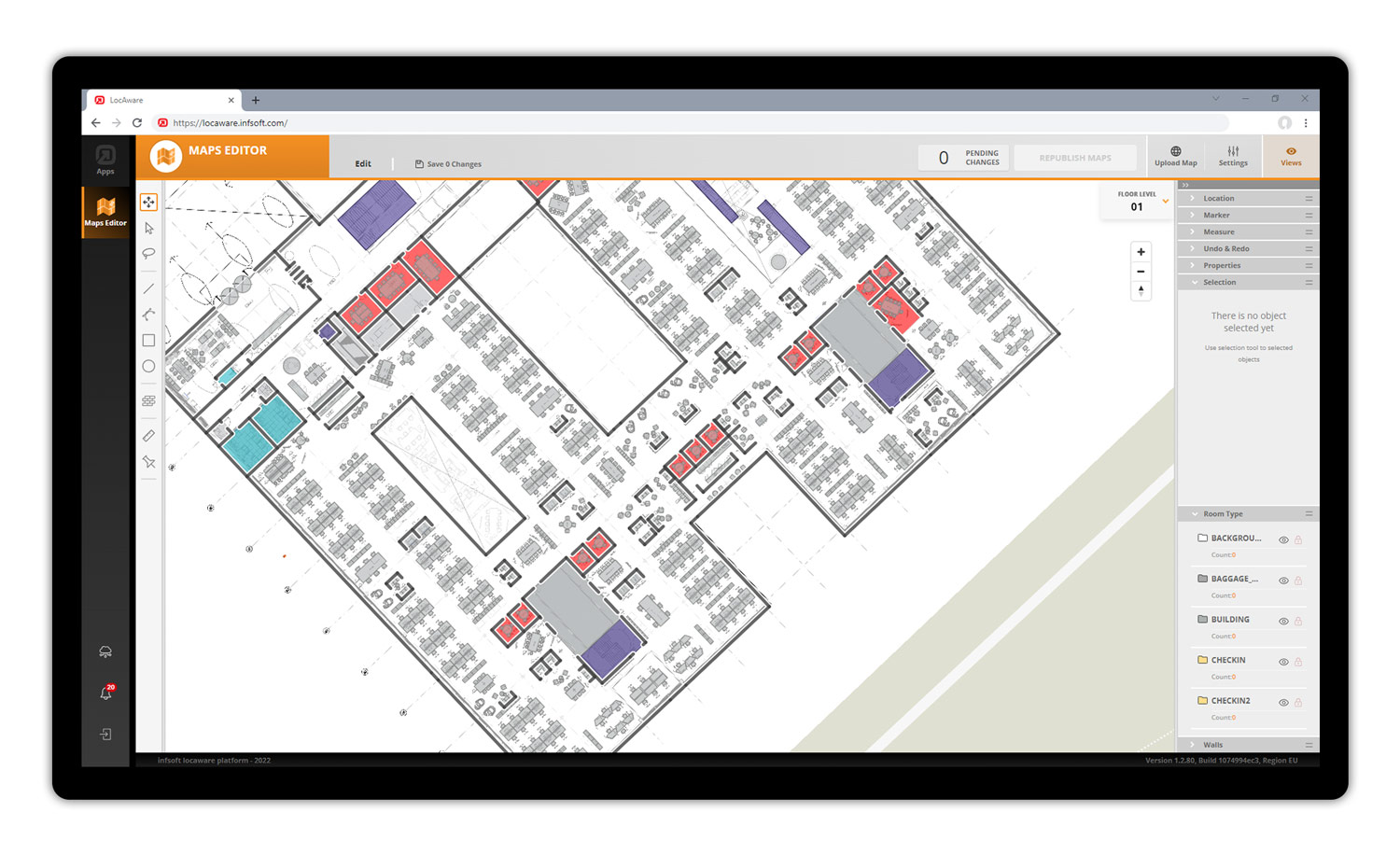
After the client receives a quote for the full-service solution, including an estimate of the required hardware, the digital mapping of the building lays the foundation for the next steps. Third-party CAFM systems can be connected for digitization. The information can then be transferred via various data formats (e.g., XML, SVG, JPG, PNG, PDF, GML, GeoJSON, DWG, DXF, Shapefile, IMDF). The infsoft Maps Editor is used to capture the plans, create spatial polygons, and define path relationships and POIs. This is followed by a color application in accordance with the client’s corporate design specifications, and the abstraction level of the plans is also defined. Further data maintenance (e.g., in case of changes) can be done by the client at any time.
2 | Planning
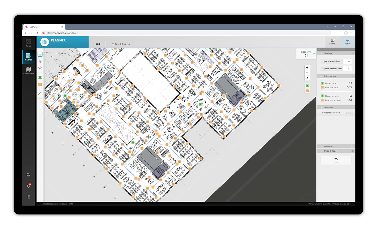
We support the client in choosing optimal installation points for the infrastructure hardware. We also pay attention to any particularities that need to be taken into account during the installation and parameterization of the hardware (such as shielding). The infsoft Planner tool enables the ideal placement of infsoft Locator Nodes and infsoft Locator Beacons. With just a few clicks, auxiliary lines are added to the building map, which automatically determines hardware installation points at the required distances. The tool also provides information on where power or Internet networks are needed. A share function allows the 2D/3D building plans, including the planned hardware, to be shared with other users. The required infrastructure and tag hardware is shipped to the client.
3 | Installation
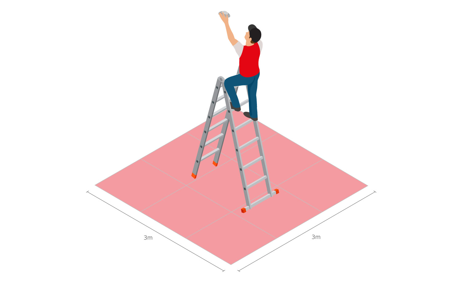
The client can easily carry out the installation on site. infsoft Locator Beacons can be attached to the ceiling using a mounting pole. Depending on the nature of the surface, the installation is carried out using a magnetic mounting bracket or a mounting bracket with an adhesive point.
With the help of ladders or steps, the infsoft Locator Nodes are mounted to the ceiling using magnetic mounting brackets. Additionally, the Locator Nodes require power and network connection. As an alternative to the Locator Nodes, the existing infrastructure of Cisco access points (with provided Locator Node firmware) can also be used.
In parallel to the installation of the infrastructure hardware, the tag hardware (BLE beacons) is attached to the assets to be tracked. Beacon and asset are paired via infsoft LocAware platform® or third-party system (e.g., ERP software).
4 | Georeferencing and Management
Via the mobile application “Locator Beacon Setup”, infsoft Locator Beacons are georeferenced within the building. Locator Beacons are identified by scanning a QR code that contains the MAC address of the Locator Beacon. Once the Locator Beacon has been scanned, its position on the digital building map can be set via the app.
Management of the Locator Beacon hardware takes place in the infsoft Locator Beacons tool. In addition to providing an overview of all Locator Beacons installed in the building, the application allows users to view battery status, set scan interval and sleep time, and perform over-the-air firmware updates, among other features.
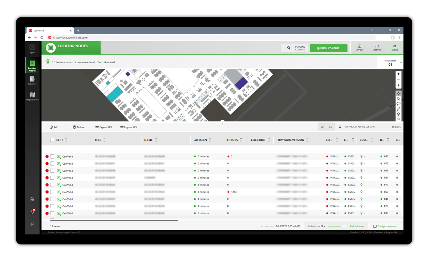
Locator Nodes are managed and maintained in the infsoft Locator Nodes software tool. The application provides an overview of Locator Nodes and their status and allows configurations of Wi-Fi connection data, upload intervals, and individual notifications.
5 | Rollout
The positioning is set up and the relevant software tools are configured in coordination with the client.
The client gains access to the tools within the infsoft LocAware platform®, which can be used for analysis, management, and automation purposes. infsoft Tracking, for example, is used to visualize the positions of individual assets, while infsoft Automation is used to define trigger logic. Web services enable fast and easy bidirectional information exchange with third-party systems. In close coordination with the client, we ensure that the configurations reflect the desired functions. We also provide support in making the best possible use of the tools so that changes can be made autonomously in the future.
Are you planning to implement an asset or people tracking project? Don’t hesitate to contact us, we will be happy to advise you.