An intermodal travel planner ensures seamless door-to-door mobility thanks to the optimal combination of transport modes.
AT A GLANCE
- 2D/3D maps
- indoor & outdoor routing
- combination of different transport modes
- interface for data integration from third-party systems (e.g. parking space occupancy)
PROBLEM DEFINITION
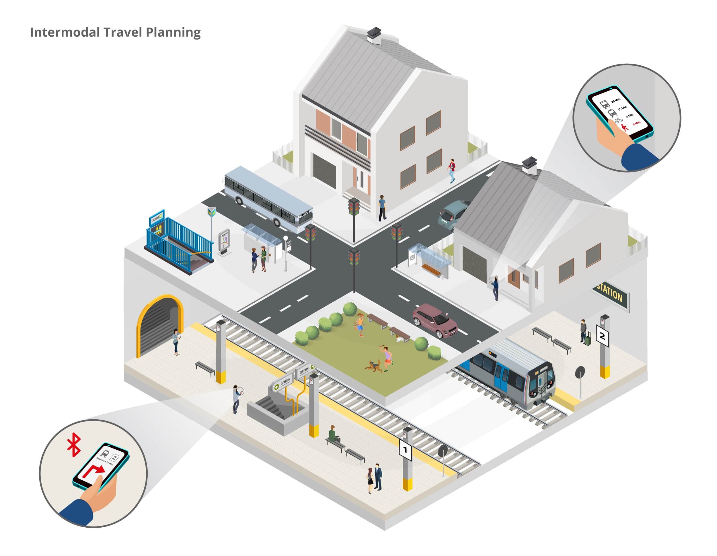
Many route planners are provider-dependent and only refer to a specific transport mode (e. g. car or public transport). Since other mobility offers are not taken into account, the traveler does not necessarily receive the shortest or most optimal route for him/her. If there is no real-time information on the route, the actual travel time can quickly deviate from the calculated time, for example due to traffic jams or train cancellations.
SOLUTION
An app uses intelligent, interconnected travel planning to select the optimal route from various mobility offers. After activating the app, the user enters his or her destination and receives various travel options that combine different means of transport (bicycle, car, bus, train, car and bike sharing). The user can choose the combination of means of transport that best suits his or her expectations of travel time, cost or use of resources. Information on the current traffic situation is included in the calculation, as are the parking lot situation at the destination or the availability of rental bicycles and vehicles. The app guides the user via turn-by-turn navigation to the stops/parking spaces/station tracks. This works both outdoors (on the basis of GPS) and indoors (based on Bluetooth Low Energy). Travel planning is dynamic and can change along the way, for example if a train is delayed or a traffic jam occurs on the planned route. Filter options allow, for example, a restriction to barrier-free routes or travel planning that only takes into account certain means of transport.
An integrated option for purchasing tickets, indoor navigation to POIs at the station (shops, restaurants, sanitary facilities) and a community function for reporting technical defects in the train or at the station are also possible.
TECHNICAL IMPLEMENTATION
The smartphone app calculates the optimal destination for the entered route using information on road and rail traffic. Supported by real-time data, the app constantly determines the best possible route and adjusts departure or transfer times.
The position is determined outdoors via GPS and indoors via a network of Bluetooth Low Energy beacons evenly distributed throughout the stations. These emit signals from which the app installed on the user’s smartphone calculates a position with an accuracy of 1-3 meters. The user is guided to his destination via turn-by-turn navigation. If desired, the data can also be transferred to the infsoft LocAware platform®, where it can be processed intelligently and used for analysis purposes, for example.
Interfaces enable the seamless integration of data from third-party systems, such as real-time information on traffic or parking situation as well as bike and car sharing offers. Via linking with the facility management of the stations, the user receives messages when there are impairments on his route, such as defects in passenger elevators, for example. The connection with a central ticketing system enables the user to buy a ticket for all means of transport directly on his/her smartphone.


