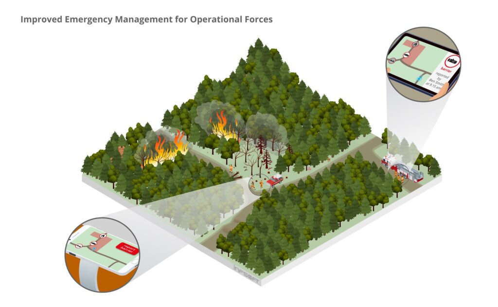
A tracking solution helps emergency responders to indicate hazards in unknown terrain and thus facilitates the strategic assessment of the risk situation for arriving forces.
AT A GLANCE
- client-based localization of emergency personnel
- indication of hazardous locations using a mobile app
- automated assignment of tasks
PROBLEM DEFINITION
Emergency missions (which may include explosions, earthquakes, fires etc.) follow a highly disciplined process, which at the same time must adapt to fully non-predictable real-life scenarios. Task forces must be able to adapt to the specific situation on site quickly, taking into account challenges posed by the complex and extreme environments and evaluating which processes and equipment are most suitable. If they lack information about the local conditions and possible restrictions, this can hinder rapid and successful emergency operations.
SOLUTION
A GPS-based tracking solution enables informing arriving forces of dangers and conditions concerning the mission. First responders who are sent out in response to an emergency can use a mobile app to flag any incident that they encounter including its location. This way, succeeding forces and on-scene coordinators can assess the mission situation in detail, enabling a much more efficient operational planning.
TECHNICAL IMPLEMENTATION
Each emergency force member is equipped with a mobile device (smartphone). An app installed on the smartphone determines the user’s position via GPS and displays it on a map in real time. In order to make the location information available to other users and data-processing tools, it can be sent to the infsoft LocAware platform®. The infsoft Workflow Management and an interface to the infsoft Automation Engine enable sending automated task assignments to the emergency personnel. This way, tasks can be assigned based on the proximity to the incident or based on the qualification of the employee, for example.


